On a map of the Lake Isle of Wight can look like a promise. Visitors scanning for a tranquil inland expanse might assume they’ve found it: a real lake, perhaps, framed by reeds and footpaths. Residents know better. Lake is not a stretch of open water but a substantial coastal settlement on the island’s south-east side, sitting between Sandown and Shanklin on the arc of Sandown Bay. It is both a place in its own right and, in the way seaside towns often blur at the edges, part of a wider urban strip that has grown steadily along the coast.
The phrase “lake isle of wight” crops up repeatedly online for a reason. People searching it are usually trying to answer one of two questions. Either they want to know about Lake the village—where it is, what it’s like, what there is to do nearby, how to get there—or they are genuinely asking whether the island has a notable lake. Both are fair questions. Both lead, if you take them seriously, into a story about geography, tourism, transport, coastal change and the peculiar way place-names can mislead.
Lake, Isle of Wight is not a showpiece resort like Shanklin, nor does it have Sandown’s long-established tourist infrastructure. It is something more ordinary and more revealing: a working coastal community shaped by Victorian expansion, twentieth-century housing, and the everyday realities of living on an island whose economy has long had to balance residents’ needs with visitors’ expectations. To understand Lake is to understand how the Isle of Wight actually functions beyond the postcards.
Where Lake sits on the island, and why it matters
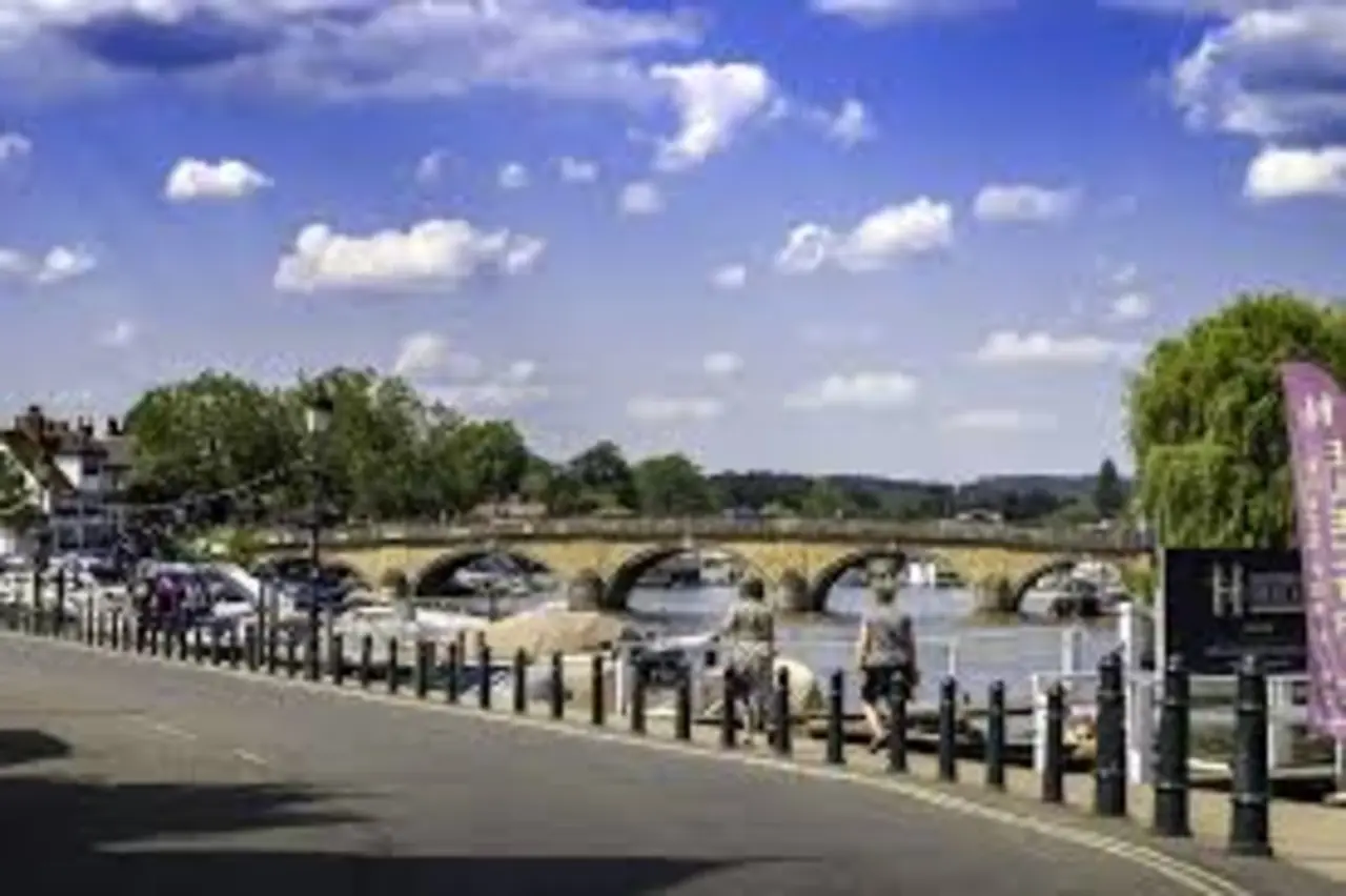
Lake occupies a strip of the south-east coast, part of the continuous built-up area that runs from Shanklin through Lake to Sandown. To the sea is Sandown Bay, a broad sweep of beach and shallows that has drawn holidaymakers for generations. Inland, the land rises gradually towards the island’s chalk spine, although Lake itself is largely on the lower coastal plain, with roads and housing following the logic of relatively flat terrain.
This geography helps explain Lake’s character. Unlike inland villages that remain defined by a historic core, Lake is more linear. It grew along routes that made sense for transport and trade: roads connecting the older settlements, and later the railway line that stitched together the island’s east side. It also developed in the shadow of nearby resorts. Shanklin, with its older tourist reputation, and Sandown, with its beachfront and pier history, tend to dominate the outsider’s mental map. Lake is often experienced as the place you pass through. But for many islanders it is where daily life happens: where you live, shop, commute, take children to school, catch a train, or walk a dog along the seafront when the season is out and the bay belongs to locals again.
That “in-between” quality is not a weakness. It can be an advantage. Lake, Isle of Wight has long functioned as a link: between towns, between the visitor economy and the residential economy, between the coast and the island’s interior. It is also, in a practical sense, part of the island’s most accessible corridor for public transport, with the rail line and bus routes running through a relatively dense area.
Why it’s called Lake: a name with history, not a literal shoreline
The obvious question—does Lake have a lake?—is the one that drives many “lake isle of wight” searches. The short answer is no: there is no large natural lake at the heart of the settlement. The longer answer is that place-names often preserve older landscapes, or older ways of describing them, long after the original feature has changed or vanished.
Across England, “lake” in a place-name can refer to water, of course, but it can also point to marshy ground, slow-moving streams, or wet hollows in the landscape. Coastal plains, particularly those close to estuaries or former lagoons, were often patchworks of damp meadows, ditches and ponds before they were drained, built over, or reshaped by modern coastal management. It is plausible that the name reflects such a history: a wetter ground condition or a small body of water that was once locally notable, rather than a substantial lake in the scenic, Lakeland sense.
What matters, from a journalistic point of view, is not the romance of the name but the consequence. The name “Lake” gives the place instant memorability, and it invites a category error. People arrive expecting water; they find a seaside community. Yet the misreading also tells you something about the Isle of Wight: it is an island of edges—cliffs, bays, creeks, marshes—rather than an island of big inland waters. Its landscape drama is coastal and geological, not lacustrine.
In other words, Lake, Isle of Wight is a reminder that a name can travel faster than a reality, and that maps can tempt us into assumptions.
How Lake grew: railways, housing and the pull of the bay
If you want to understand how Lake became what it is, it helps to picture the nineteenth-century coastline: resorts beginning to form, sea bathing becoming fashionable, and the island’s reputation solidifying as a place of leisure and fresh air for mainland visitors. The Isle of Wight’s seaside towns expanded during the Victorian period, not only in response to tourism but also because transport links made it viable to move around the island with greater ease.
The arrival and development of railway lines changed the social geography. Railways created new nodes—stations that were not necessarily in old village centres but became centres in their own right. Lake’s station, still a key identifier today, anchors a particular kind of development: residential streets, small businesses, and routes that align with getting people from homes to trains, and from trains to the seafront.
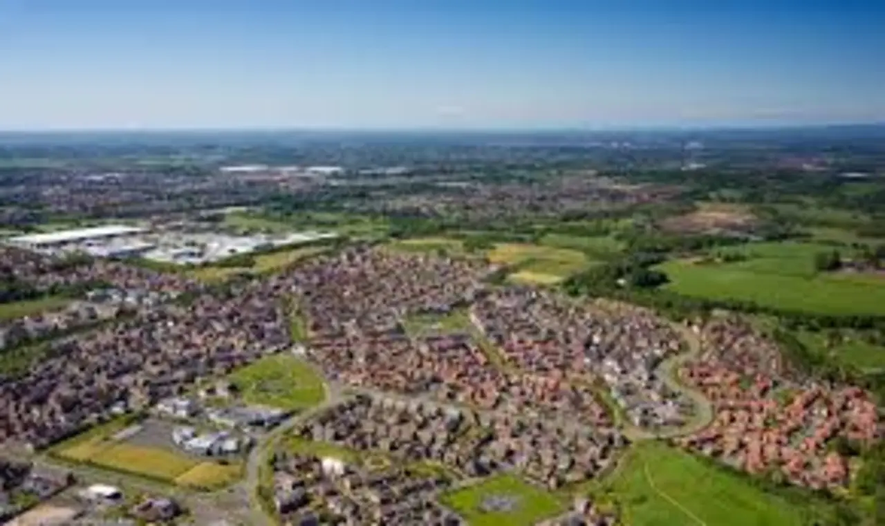
Over time, Lake filled in the gaps between Shanklin and Sandown. What might once have been distinct settlements separated by fields became a more continuous urban strip. That pattern is common in coastal areas where buildable land is constrained between sea and rising ground. The result is a place that can feel less like a single village with a historic core and more like a lived-in coastal district with multiple small centres: pockets of shops, schools, parks, churches and community facilities spread along the main routes.
The twentieth century added further layers. Housing demand did not always come from tourism. People needed places to live that were affordable and practical, and Lake’s position made it appealing for those working in nearby towns or in service industries tied to the visitor economy. Like many parts of the Isle of Wight, it also reflects post-war housing patterns, with estates and infill development creating a mix of architectural styles rather than a single uniform look.
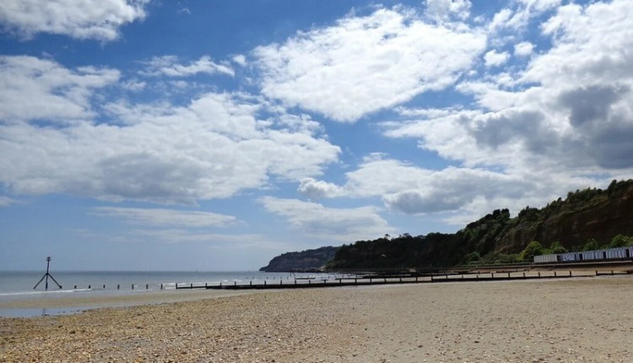
The coast at Lake: Sandown Bay, beaches and the reality of sea defences
Lake’s seafront is part of the long curve of Sandown Bay, where the beach tends to be broad and accessible, with the kind of open horizon that makes the south-east coast feel expansive on a clear day. For visitors, the bay is often experienced as a leisure space. For residents, it is also infrastructure: a line that must be maintained and defended, not only for tourist enjoyment but because housing and roads sit close enough to the sea for coastal change to be a constant concern.
Coastal erosion and flooding risk are not abstract issues on the Isle of Wight. They shape planning decisions, insurance calculations, and political arguments about public spending. Sea defences—groynes, revetments, maintained seawalls—are part of the everyday landscape. They can appear unlovely, yet they are an expression of a bargain: keep the shoreline stable enough to protect property and maintain the economic asset of the beach.
The coast also shapes daily rhythms. In summer, the seafront belongs to holidaymakers, and the atmosphere shifts accordingly. In winter, the beach can feel almost austere. That seasonal cycle affects businesses and employment, and it affects how residents experience their own home. Lake, Isle of Wight is one of the places where the island’s tourist identity most clearly meets its lived reality.
Inland from the promenade: green edges and the wider landscape
Although Lake is coastal, it is not cut off from the island’s varied inland landscape. A short distance away are areas of marshland and meadow that connect to larger ecological stories on the Isle of Wight: wetlands that matter for birds, drainage channels that recall older land uses, and the patchwork of fields and hedgerows that still defines much of the countryside beyond the built-up strip.
One of the advantages of living in or near Lake is that you can move quickly between environments. Within minutes you can be at the sea, then on a path that feels semi-rural, then back in streets and shops. That mix is part of the island’s appeal for residents as much as for visitors, though it comes with pressures. Increased footfall, housing demand and traffic can strain the very spaces that make the area attractive.
For those interested in “lake isle of wight” as a nature query—hoping for an inland watery landscape—the closest equivalents are the island’s marshes, ponds and managed water bodies, rather than a single iconic lake. The island’s ecological richness often lies in these less glamorous areas: habitats that don’t photograph as neatly as a mountain lake but support a surprising range of wildlife.
Transport and connectivity: the practical Lake
Lake is one of the places on the Isle of Wight where transport feels relatively straightforward by island standards. The Island Line railway runs through the area, linking it northwards towards Ryde and the ferry connections to the mainland. For commuters, students and day-trippers, that matters. Island life is shaped by the simple question of how easily you can get from A to B without a car, and in this part of the island the answer is generally better than in more rural districts.
Lake’s station also plays a subtle social role. It is a shared point. People from different backgrounds use it for different reasons: employment, education, healthcare appointments, nights out. That everyday mixing is one of the reasons places like Lake can feel more socially varied than postcard villages.
Road links are equally significant. The main coastal routes connecting Sandown, Lake and Shanklin carry traffic that can swell dramatically in peak season. The island’s roads, often constrained by historic settlement patterns and limited space, can feel under strain when visitor numbers surge. For residents, transport is not simply a convenience; it is part of the broader debate about how the Isle of Wight manages its economy and its infrastructure.
If you are searching “lake isle of wight” because you are trying to plan a visit, the practical truth is that Lake is less a single destination and more a well-placed base for moving around the south-east coast. But it is also, and more importantly for residents, a functional place with the transport links that allow ordinary life to continue.
Shops, services and the shape of everyday life
Lake is not defined by a single high street in the way older towns sometimes are. Its services are distributed along main roads and within residential areas. That can make it feel less picturesque, but it makes it practical. People live here because it works.
Daily life on the Isle of Wight is shaped by questions that visitors can overlook: where are the nearest supermarkets, surgeries, schools, and leisure facilities? How far is it to the nearest job centre, college, or large employer? How reliable is public transport in winter? How does seasonal work affect household income? Lake sits within the answers to these questions.
There is also a social reality to a place like Lake. Coastal communities can contain sharp contrasts. Alongside families with deep roots on the island are those who have moved for work, for lifestyle reasons, or for retirement. Some housing is occupied year-round; some is tied up in seasonal use. In certain streets, the mood changes with the calendar, as holiday occupancy rises and falls. That rhythm is not unique to Lake, but it is particularly visible in the Sandown Bay area, where the line between “resort” and “home” is thin.
To describe Lake, Isle of Wight accurately is to resist easy labels. It is not simply a tourist strip. It is not simply a dormitory. It is a place where the island’s dependence on seasonal income is woven into ordinary routines.
Housing, affordability and the pressure points
Housing is one of the most sensitive issues on the Isle of Wight, and Lake is no exception. The area’s attractiveness—coastal setting, relative connectivity, proximity to established resorts—can drive demand in ways that push against local wages. That tension is familiar across many parts of coastal Britain. It is sharpened on an island where supply is constrained, building land is contested, and the employment base is often weighted towards lower-paid service work.
Lake’s housing stock reflects waves of development. There are older terraces and villas that speak to earlier expansion, mid-century estates that mirror national patterns, and newer builds that fill in gaps. Some properties have been adapted for holiday use; others remain firmly within the year-round rental and owner-occupier market. Each category has implications for community stability, school enrolments, and the viability of local services outside the summer.
Planning debates on the Isle of Wight frequently revolve around how to accommodate demand while protecting the landscapes that define the island. In the Lake area, the stakes include coastal resilience, drainage, and the capacity of roads and public services. These are not glamorous issues, but they are the ones that shape whether a place remains liveable for those who are not visiting.
The visitor economy and the resident economy: a permanent negotiation
Sandown Bay has long been tied to tourism, and Lake lives with the benefits and costs of that fact. Visitor spending supports jobs and businesses. It keeps certain amenities viable. Yet it also creates a seasonal economy, where employment can be insecure and where the summer months place pressure on transport, waste services and healthcare.
There is a tendency in public discussion to treat tourism as either an uncomplicated good or a corrosive force. The reality is more nuanced. In places like Lake, Isle of Wight, tourism is not something that happens “over there” in a resort bubble; it happens in the same streets where children walk to school and where older residents shop for groceries. The challenge is not to wish it away but to manage it so that residents are not treated as an afterthought in their own community.
This negotiation shows up in small things: parking, noise, seasonal crowding. It also shows up in larger structural questions: whether local jobs can offer year-round stability, whether housing remains accessible, whether public transport is designed for residents or primarily for the summer surge.
Lake’s location between two well-known resorts means it can sometimes be overlooked in broader narratives about the island. But it is exactly the kind of place where these trade-offs are most visible.
The “lake” question properly answered: does the Isle of Wight have lakes?
Because “lake isle of wight” is often typed by people expecting a literal lake, it is worth answering clearly. The Isle of Wight does not have large natural lakes comparable to those in parts of northern England or Scotland. Its water features tend to be smaller and more managed: ponds, marshes, reservoirs, and inlets where rivers meet the sea.
There are man-made reservoirs on the island, such as Ningwood Reservoir in the west, which play a role in water supply rather than recreation. There are also wetland areas and marshes—ecologically important landscapes that can look lake-like from a distance, especially when water levels are high, but which are not “lakes” in the conventional sense. The island’s rivers are modest, and much of the drama in its hydrology is about drainage, coastal interaction and low-lying land, not big inland basins.
So when people ask about Lake, Isle of Wight, they are often mixing two different things: a place-name and a landscape type. The irony is that the island’s watery environments are often more subtle than a postcard lake, but they are no less significant. They are part of what makes the Isle of Wight environmentally distinctive, particularly for birdlife and coastal ecology.
What Lake reveals about the Isle of Wight’s identity
The Isle of Wight is routinely described through its extremes: dramatic cliffs, historic sites, festival crowds, and seaside nostalgia. Those are real. But places like Lake tell a different story, one that is closer to how most islanders experience the island most of the time.
Lake is not primarily about spectacle. It is about continuity. It is where the island’s seasonal economy meets year-round living; where transport links matter not for day trips but for work and school; where coastal beauty sits alongside the hard engineering of sea defences; where the name on a sign can mislead, yet the place behind the sign has its own quiet solidity.
It is also a reminder that the Isle of Wight is not one thing. It contains affluent pockets and struggling ones, tourist-facing streets and purely residential estates, areas shaped by second homes and areas shaped by local multi-generational ties. The south-east coast, including Lake, carries many of these complexities because it is accessible, attractive and densely settled.
For someone researching “lake isle of wight” with a view to understanding the area, the most useful approach is to see it as a lived community within a wider coastal conurbation, not as a standalone tourist destination and certainly not as a mysterious inland lake. It is a place where the island’s broader challenges—housing, infrastructure, seasonal pressure, coastal change—play out at street level.
Conclusion: a name that confuses, a place that deserves precision
Lake, Isle of Wight is a good example of why place-names need to be treated with care. The name invites a picture that doesn’t quite exist, and it can leave the uninitiated briefly disoriented. But once the confusion clears, Lake emerges as something more instructive than a scenic feature: a functioning coastal community shaped by transport corridors, housing patterns, tourism pressures and the everyday business of island life.
If you came looking for a lake, you will not find one. If you came looking to understand a part of the Isle of Wight that is less postcard-perfect and more representative of how the island actually works, Lake is a telling place to start.